Photo via Pexels
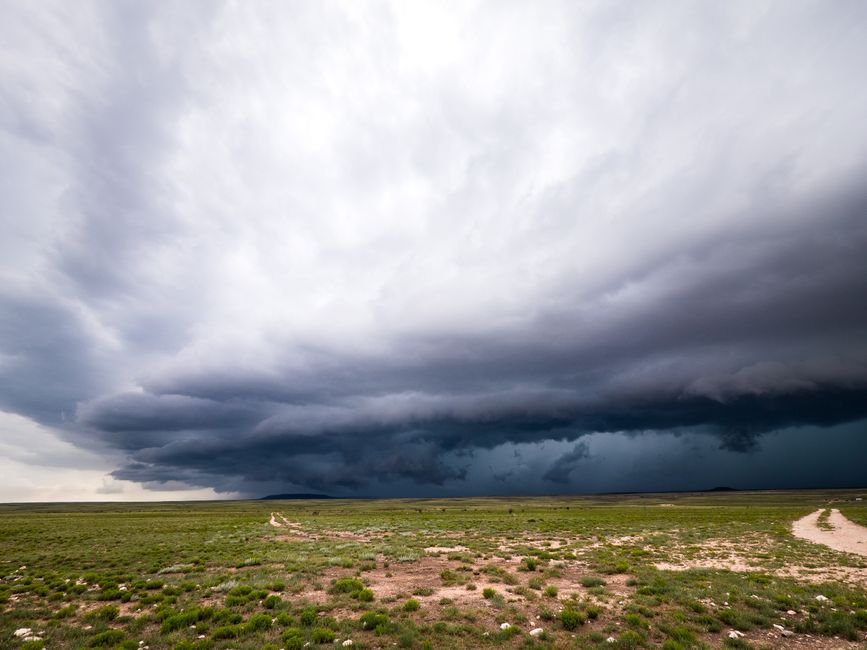
Researchers at the National Oceanic and Atmospheric Administration (NOAA) have advanced the use of ground-based infrasound arrays to track and characterize severe weather events, including tornadoes and hurricanes, with unprecedented accuracy. They demonstrated that specific infrasonic signatures, below the range of human hearing, are reliably generated by intense atmospheric turbulence, lightning, and microbursts within storm systems. The methodology involves analyzing data from a network of highly sensitive microbarometers, which detect minute pressure fluctuations from distant storms, allowing for triangulation and identification of their intensity and direction. This capability offers a novel, passive method for monitoring dangerous weather phenomena, providing complementary data to radar and satellite imagery, especially in remote or data-sparse regions. It is a surprising revelation that storms 'sing' in a way we cannot hear but can be precisely tracked.
Editorial check
How this page is checked
Source trail
Editorial source pending
External links are separated from Surfaced commentary.
Reader safety
Context before clicks
Product links and external services are not presented as guarantees.
Monetization
No affiliate flag
Ads and commerce links are kept distinct from editorial text.
Surfaced take
Why It’s Fascinating
Experts were surprised by the distinctiveness and reliability of the infrasonic signatures, providing a new dimension for understanding severe weather dynamics that was previously inaccessible. This confirms that even invisible atmospheric processes leave a unique acoustic fingerprint, enhancing our predictive capabilities beyond traditional meteorological tools. Within 5-10 years, integrating infrasound data into operational weather forecasting models could lead to earlier warnings for severe storms, saving lives and reducing property damage. Imagine an invisible weather radar that listens to the growl of a distant tornado long before it's visible. Meteorologists, emergency management agencies, and everyday people in storm-prone regions benefit most. Could this technology eventually provide fine-grained insights into the internal mechanics of storm formation?
Related

VisiData
VisiData is a free and open-source command-line tool developed by Saul Pwanson, designed for quickly exploring, cleaning, and summarizing tabular data directly…

Hypothesis
Hypothesis, a non-profit project developed by the Hypothesis Project, is an open-source web annotation tool that enables collaborative reading, note-taking…
Enjoyed this? Get five picks like this every morning.
Free daily newsletter — zero spam, unsubscribe anytime.